Smart tools and systems for exploring the frontier
Main Content
THOR: Thermal High-voltage Ocean-penetrator Research platform
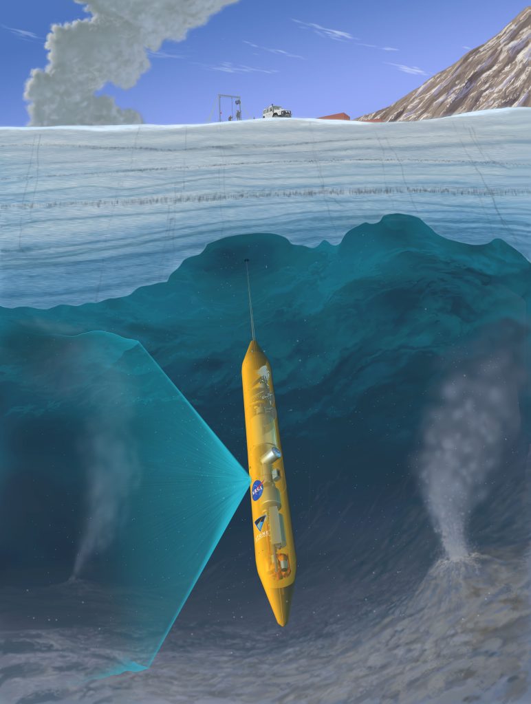
THOR is a prototype for a new class of exploration vehicle which combines elements of an ice-penetrator (cryobot) and an ocean-profiler (sonde) for future Ocean Worlds exploration.
The full THOR vehicle is a Closed-Cycle Hot Water Drill (CCHWD) cryobot able to penetrate up to 500 m of ice and able to transition to an actively spooled sonde upon breakthrough into the water, a vehicle architecture we term an IOP (Ice-Ocean Penetrator). The vehicle actively spools a tether — providing a vertical control capability enabling controlled breakthrough into the water body, active profiling of the lake chemistry, and re-spooling and recovery to the surface. While Ocean World applications will require nuclear power, the tether also enables THOR to be powered from the surface via high-voltage electrical power to our unique hot-water heating design able to emulate the power density of a Kilopower reactor. The full THOR vehicle will carry a sampling subsystem as well as spatial, environmental, and life-detection sensors to characterize the ice and water it transits through. This platform and sensor suite will then be used to develop and test strategies and behaviors for autonomous exploration and sampling as the vehicle descends through an ice column and into and through a subglacial water body below.